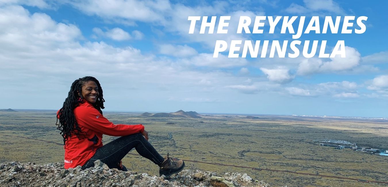
After most visitors to Iceland arrive at Keflavik international airport, they quickly grab their bags and set their sights on traveling to downtown Reykjavík. Unfortunately, the don’t give any thought to visiting the rest of the Reykjanes Peninsula.
Little do they know that a beautiful, less crowded and completely underrated place waits just outside of the airport. I was delighted when I found out that this peninsula had been designated a UNESCO Global Geopark in 2015.
I have been fortunate to travel to this area on several occasions. When there, I am always pleasantly surprised by how amazing and diverse the landscape is. While I don’t want this peninsula to become overcrowded with visitors, I do think it is a shame that more people do not explore this place. It is literally brimming with geothermal activity, mud pools and lava fields. It is also home to so many hiking trails and fascinating Icelandic history.
Most notably, it is one of the best places to see the separation of the Eurasian and North American tectonic plates. After learning more about this place, I decided it was worth it to dedicate this episode to the Reykjanes Peninsula.
The Unique Geology of the Reykjanes Peninsula
During one of my visits to the area I found the geology to be quite interesting. After looking up how the area was formed, I found the following quote from Visit Reykjanes brochure. Just a heads up, there is some science lingo in the quote but I still think it is worth sharing,
“Reykjanes Peninsula is an important region from a geological standpoint. It is a geologically young section of Iceland and is a land born and highly volcanic counterpart of the North Atlantic Ridge where the tectonic plates diverge at an average rate of 2.5 cm/ yr. The peninsula contains late Quaternary volcanic palagonite tuff and pillow lava formations as fells and mountains from the last glacial periods. Widespread basaltic lava flows and volcanic structures from interglacial periods, especially from the last 11,500 years (the Holocene Era) characterise the area. Four elongated volcanic systems and fissure swarms line the peninsula from SW to NE. They contain open fissures, normal faults, high temperature geothermal fields and numerous volcanic fissures that are lined with monogenetic craters.”
Whether you care about the science behind how this area was formed or not, the beauty and the uniqueness of the landscape can’t be denied.
Where is the Reykjanes Peninsula & How to Get There
Before jumping into what to see and do in this part of south Iceland, I think it is important to go over where it is and how to get there. As I mentioned in the beginning, this peninsula is in the south of the country, specifically the south-west.
The towns and villages that make up the Reykjanes Peninsula include Suðurnesjabær, Grindavík, Vogar, and Reykjanesbær. If it is relatively clear when you are flying into Iceland, you can get a glimpse of the stark black sand beaches along the coastline and the jagged lava rock that dominates this part of the country.
By car, it is very easy to drive around the peninsula. Whether you rent a car on your own or take a tour. However, the real fun begins when you get out of the car and explore on foot.
Different Towns on Reykjanes Peninsula
Each of the towns of the peninsula that I mentioned above have unique features that attract visitors. For instance, Reykjanesbær, which is the municipality that is home to Keflavik international airport is made up of three districts: Keflavík, Hafnir and Njarvík. With a population of a little over 15,000 people, it is the largest town on the peninsula. There you will find different types of accommodations, stores, bars and museums.

Suðurnesjabær
Suðurnesjabær is a fairly new municipality in Iceland. In 2018, it was created by merging Garður and Sandgerði and it has a population of about 3,000 people. There are a plethora of outdoor activities to do in this part of the peninsula.
In addition to having spectacular sea views and two awesome lighthouses to experience, this area is brimming with bird life and seals. There is even the possibility of seeing dolphins swim near the shore. Surprisingly, there are white sand beaches here, which you will only present in certain areas of the country. If you have a motorhome, want to camp or have a trailer, there is a local campsite with amenities like toilets, running water and electricity.
Within this municipality is the northern tip of the peninsula. In addition to bird watching and golfing, there is a unique souvenir shop called Listatorg that sells a variety of handmade goods. Additionally, the Suðurnes Science and Learning Center is located there. If you have an interest in exhibitions about Icelandic nature, sea creatures, wildlife and any research related to those topics,I recommend taking time to visit the center.
Vogar
Vogar has a population of a little over 1,100 and the town is an old fishing village. What is absolutely fascinating about this place is that even though it mainly has lava fields that span from the ocean to the mountains, it is the largest agricultural area on the peninsula.
In this municipality, you can take a stroll along the pond Vogatjörn, visit the old harbor and check out the íslands Hrafnistumenn monument, which was erected in memory of local fisherman. There is a golf course in this area as well. Even if you don’t care much for the sport, you might still be interested in visiting to check out one of the largest timber churches in Iceland. It just so happens that the golf course encircles that building.
If you are anything like me, you’re probably interested in knowing where the hiking trails are in Vogar. Mount Keilir is one of the most recognizable landmarks in the area. While it looks quite steep, it is not a difficult hike. You can also check out Hrafnagjá, a normal fault and tension fracture that is the longest on the peninsula. This 12 meters long and 30 meters high set of fractures forms a valley rift. There is an easily accessible hiking trail to it from the parking area.

Grindavík
The third municipality that makes up the Reykjanes peninsula is Grindavík. This place is home to the world famous Blue Lagoon. So many visitors that have gone to the Blue Lagoon were not aware of the other activities in the area. Just to give you a little background about Grindavik, it has a population of about 3,300. Most of the people that live there base their lives around fishing or the fishing industry.
This small town provides more than 40% of Iceland’s salt fish production. It is still one of the most active harbors in the country. The landscape surrounding the town looks eerily like the moon and there are lovely hiking trails there. It is worth noting that this southwestern town is home to one of Iceland’s best golf courses. Kvikan, which is a house of culture and natural resources, is also located here.
Top 10 Places to Go on the Reykjanes Peninsula
Because there are over 50 spots on this peninsula to check out, I decided to give you the top 10. However, here is a link to the brochure from Visit Reykjanes that has a plethora of information about this fascinating part of the country.
- The Blue Lagoon
- This spa is famous for a reason. While it is visited by a lot of tourists each year, I think it is worth checking it out at least once.
- Gunnuhver
- These smelly mud pools and steam vents are pretty cool to check out but there is an added bonus. They are names-d after a female ghost that was laid there. She was kind of a pain in the butt and caused trouble. That stopped after a priest tricked her into falling into the spring 400 years ago.
- Reykjanes Light House
- It’s the country’s oldest lighthouse. The original was built in 1878 but ended up being damaged by an earthquake. Another lighthouse was built in 1907 and is currently the one that people visit today. In 2007, it was voted as the favorite lighthouse among Icelanders
- Krýsuvíkurberg
- This area is fantastic for birdwatching and the steep sea cliffs span for many kilometers along the coast. There are so where around 60,000 birds couples that make those cliffs their homes during the summer. An added bonus is that from the highway, you can find a hiking trail that takes less than an hour to walk.
- Kleifarvatn
- Kleifarvatn is a gorgeous lake. It is the largest on the peninsula and the third largest in South Iceland. While there is some hot water that runs into the southern part of the lake, the rest of it is cold. If you are a photographer this lake is a great place to go. The contrast of the volcanic landscape and the lake’s blue water are really nice to capture in a photo or on film.
- Bridge Between Continents
- The Bridge between continents is interesting because there is literally no other place like it. What I find to be interesting is the moon like landscape under the bridge and the formation of the rocks on each side of the continental divide. I do have to say though that is not exactly the most exciting place in Iceland or even on Reykjanes Peninsula. I just find it interesting because of the unique geology. You can even get a certificate that says you walked between continents after you walk over the bridge. Honestly I think people will believe you if you just tell them you did it.
- Keilir
- Keilir is a mountain that was created during subglacial eruptions in the ice age. It is a landmark in the area and is thought of by some as a symbol of the peninsula. Even though it has steep slopes, it is not very difficult to hike. The awesome part is that you will be rewarded with amazing views if it is a clear day.
- Brimketill Lava Rock pool
- Along with the Brimketill lava rock pool being absolutely stunning, it’s funny to know that. According to a local legend, a troll woman named Oddný used to occupy the pool. Some people are brave enough to take a dip in the chilly waters. I urge anyone that is visiting this place to be careful because this a natural location. The conditions of the sea can change quickly and you might find yourself swept out into the ocean.
- Duus Museum
- The Duus museum is quite unique because it packs in a lot of great exhibitions into a series of buildings. You can spend a decent chunk of time checking out all of the history in this space. For instance, the Maritime center displays over 100 model boats hand-crafted by skipper Grímur Karlsson. Additionally, there is a movie hall, an art hall, the Reykjanes Geopark visitor center, and the heritage museum
- Viking World Museum
- If you are interested in learning about the life and history of Vikings, then check out Viking world Iceland. The coolest attraction there is an authentic Viking ship that was built by Gunnar Marel Eggertsson in 1996. To celebrate the passing of a millennium since the journey of Leifur Eiríksson to the New World, the ship was sailed to New York in 2000.
Of course there are plenty of other places to visit. Some of them include lovely churches, museums and natural wonders. However, I think the ones on my list are for sure worth a visit.
Random Fact of the Episode
- Nanna Bryndís Hilmarsdóttir, Of Monsters and Men lead singer is from this area
- There is a U.S. Navy base at Keflavík International Airport called the Naval Air Station Keflavík. It was built during WWII by the US Army and was once home 5000 troops. The reason for the base was to secure north Atlantic air routes and to defend Iceland against an attack. It was mostly used for getting people, equipment and supplies to Europe for the war. Because it was only meant to be a temporary wartime base, the U.S. military left in 1947.
However, they returned in 1951 and were labeled the Iceland Defense Force. It was operated as a NATO base. The naval air station closed on September 8th, 2006 and the Icelandic Defence Agency took over the facilities until 2011. At the time, the agency stopped operation and the base was given to the Icelandic Coast Guard, which still has control over it. The base has been visited by the American military and other NATO allies for military exercises. The barracks that the troops used to live in have since been converted into housing for students. You can easily spot the old barracks near the main road that leads to the Keflavík airport because they have been painted with very bright colors.
In 2017 the U.S. announced that it wanted to modify the largest hangar on the airbase so it can accommodate a new Boeing P-8 Poseidon. Some people have wondered if that means U.S. troops would come back to occupy the area, but that doesn’t seem to be the case. However, you never know what can happen in the future so I am not ruling out the possibility.
Icelandic Word of the Episode
Bláa Lónið – Blue Lagoon
I hope you enjoyed listening to this episode. I release a new podcast episode every week. Make sure you are subscribed to the All Things Iceland podcast so you don’t miss new episodes. If the platform you are listening to this podcast on allows you to leave a review, please do so, if you haven’t already.
Þakka þér kærlega fyrir að hlusta (og að lesa) og sjáumst fljótlega
Thank you kindly for listening (and reading) and see you soon!